T1/11 — Port Vice City
Independent fan research. Not affiliated with Rockstar Games or Take-Two. Reviewed 27 October 2026. Map placements are unverified; scene groups and theories are hypotheses, not confirmed missions.
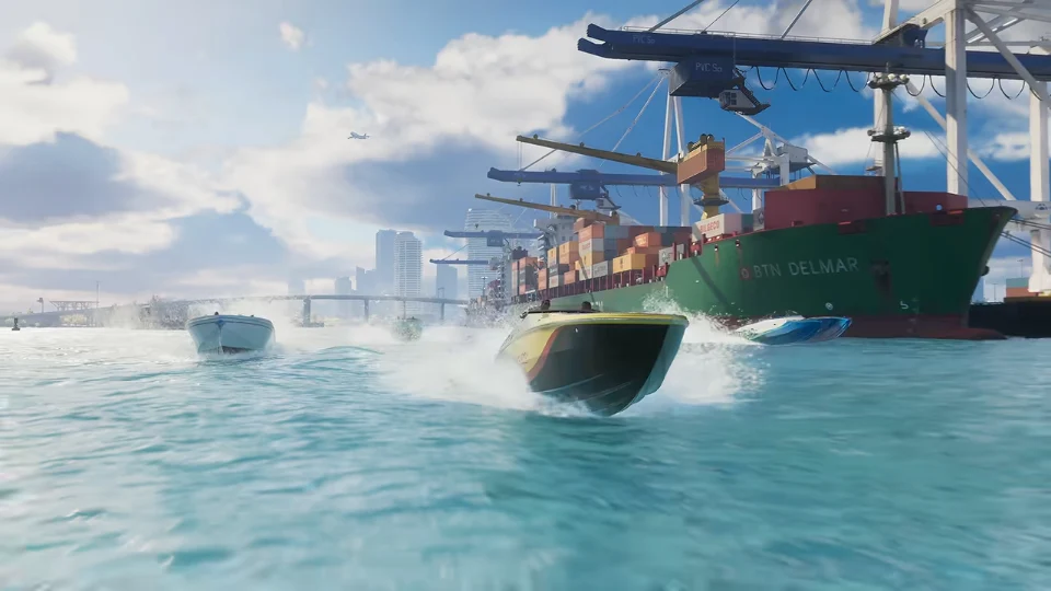
Timestamp identifies the retained video frame. The linked video starts at a rounded second; use the exact PTS above for frame matching.
Watch the official trailer · Community map proposal · Inspect on the interactive map
Map position
- status
Community proposal · exact position unverified
- community source coordinates
- lat
-790.75
- lng
1531.25
- normalized atlas position
- x
882.44
- y
707.445
- note
These are fictional map coordinates, not GPS. Exact placement and camera heading are unverified.
Character appearances and confidence
No named character established in this frame.
Unidentified subjects
Geography review
- outcome
corridor_fit
- anchor semantics
Offshore viewpoint/boat corridor versus quay/crane objects.
- observations
Container cranes, a cargo vessel, open foreground water and a small motorboat are visible.
- comparison
The source camera point is in the water southeast of the mapped port.
A westward view toward the long quay/crane rows is broadly compatible with the reconstruction.
- limits
A port scene is not enough to identify an exact crane, berth or vessel-camera position.
The source point lies in water and should not be presented as the port building/object coordinate.
- alternatives
Another nearby offshore viewpoint along the same quay.
A separate quay/object area with its own anchor.
- decision
Retain an offshore viewing corridor and a separate port-object interpretation; exact point remains unverified.
- next test
Match crane count/spacing, quay orientation and a fixed shoreline/bridge feature behind the vessel.
Source label checks
No source-label conflict recorded.
Pending frame checks
- category
Geography
- priority
Normal
- action
Match crane count/spacing, quay orientation and a fixed shoreline/bridge feature behind the vessel.